 (0)
(0)
 Share
Share
Escape the Stress of Work and Find Solace at River Bluff Cabins
Sep 22-2023 | Riley Bartel
We’ve assembled a collection of the various Garner State Park Maps for you to help narrow down your search and help you plan your expedition. Below are short descriptions and downloadable links you can print directly from:
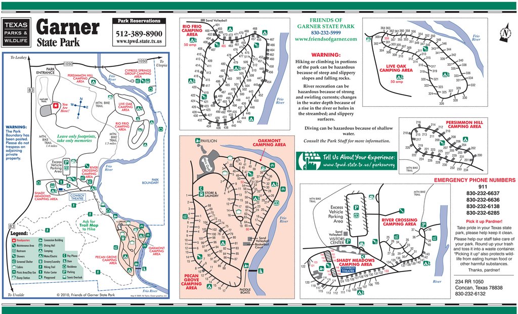
This map provides an overview of all the park camping areas; Rio Frio, Live Oak, Permission Hill, Oakmont, Pecan Grove, Shady Meadows and River Crossing. It also includes a small map of the Frio River.
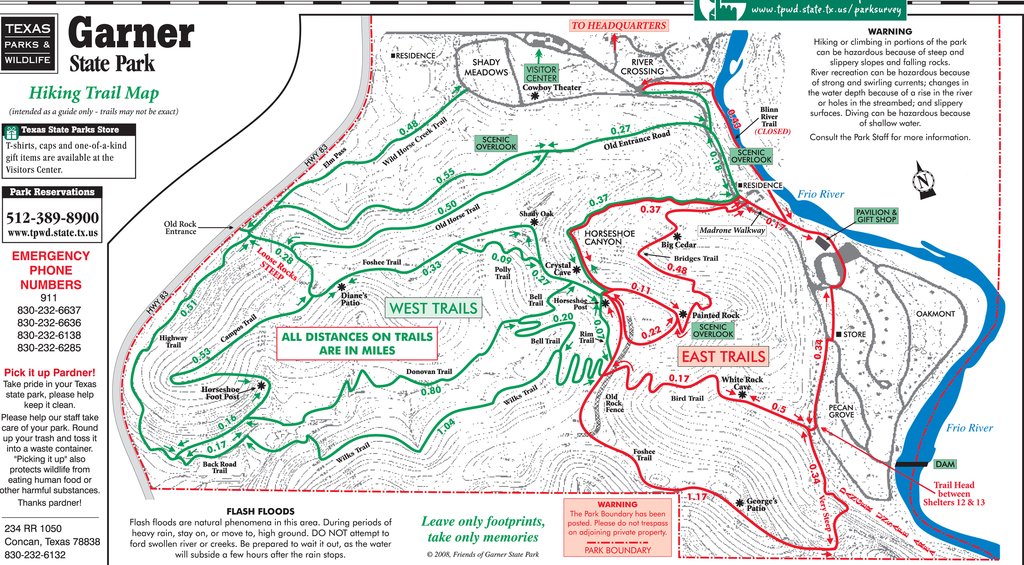
Probably the most valuable planning tool, this map covers nine (9) different points of interest and ten (10) different trails. This is a great hiking and mountain biking guide. Most of all, it really helps you chart out your Garner experience because there’s so much to do and see as a natural explorer.
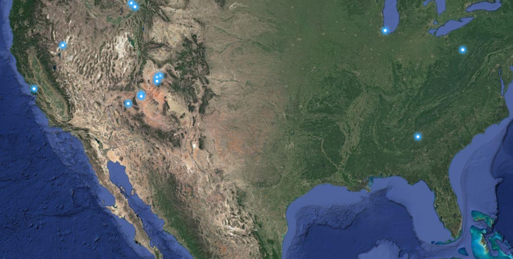
If you’ve got Google Earth and want to take a virtual tour of the parks landscape this is a great mapping tool for doing that. You’ll certainly get an idea of the terrain and all there is to see and love about Garner.
View the Interactive Trail Map

Escape the Stress of Work and Find Solace at River Bluff Cabins
Sep 22-2023 | Riley Bartel

Summertime Fun at River Bluff Cabins, the Best Resort on the Frio River!
May 22-2023 | Riley Bartel

Head to River Bluff Cabins on the Frio River for Spring Time Fun
Mar 09-2023 | Riley Bartel

Unwind in Nature at Posada del Frío
Nov 04-2022 | Riley Bartel

River Bluff Cabins - The Perfect place for a Family Vacation
Oct 05-2022 | Riley Bartel
Comment(0)